Members are reminded to be “situationally” aware of possible “Pilot Deviations” during ground and airborne operations in our local airspace. The FAA has issued a “Safety Enhancement Topic” (September 2014) with additional information on the subject that we should give some thought to during preflight planning and flight operations. Here are a few additional points from that article:
- Most GPS systems and many handheld displays will display different forms of controlled, restricted airspace, and even TFR data. This is a great advantage to your ability to avoid an airspace violation. Be sure that your reference database is up-to-date.
- Enroute radars (Center) are not as accurate as terminal area radar. Aircraft GPS systems are more accurate. However your onboard GPS may indicate you are clear of an airspace boundary while the FAA enroute radar may not. You could be investigated for a possible deviation. Your GPS data can be downloaded and used to clear up the issue. However, this is probably not the way to meet your local FAA representatives. It would be wiser to maintain at least a mile of horizontal separaton and at least 500 ft vertically.
- The timing for TFR restrictions are never exact. Always confirm with local ATC that in fact the TFR has expired.
- Keep in mind that there is a “defacto” TFR over any football stadium with capacity of 30,000 or more. There are more of these than you think!
- Our Aircraft Garmin GPS navigators have the means to establish a vector course, You can use this to be sure you avoid any airspace issues.
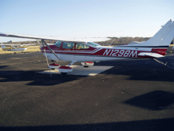
Come on out and fly! Try our latest C172!


